Mining Solutions
Eyes Above the Earth: Where Drones Become Mining’s Silent Guardians
Drones aren’t gadgets—they’re your mine’s watchful sentinels. Soaring where boots can’t tread, they reveal terrain truths and shield your teams from harm, turning landscapes into living data.
Unearth More Than Minerals
We arm your skies with drone fleets engineered for mines. Their mission? To capture the unseen:
- Millimeter-perfect terrain maps exposing shifting slopes and unstable ground before it groans
- Thermal eyes spotting overheating conveyors or silent methane leaks
- Real-time 3D models that turn stockpiles into auditable digital gold
- AI patrols guarding remote perimeters against trespassers and theft
This isn’t just data—it’s your competitive edge carved from the clouds.
Safety Flies With Us
When every second counts, our drones become first responders:
- Thermal sensors pierce through smoke during fires
- LiDAR scans trap zones post-collapse
- Live feeds guide rescuers—keeping humans out of harm’s way
- Automated alerts to emergency response teams for faster intervention
- Night-vision surveillance enhances perimeter security during low-visibility operations
Transform risk into responsibility. Let drones shoulder the danger.
We provide comprehensive mining solutions using advanced drone technology, IoT and AI to optimize mining operations and enhance safety. Our services include
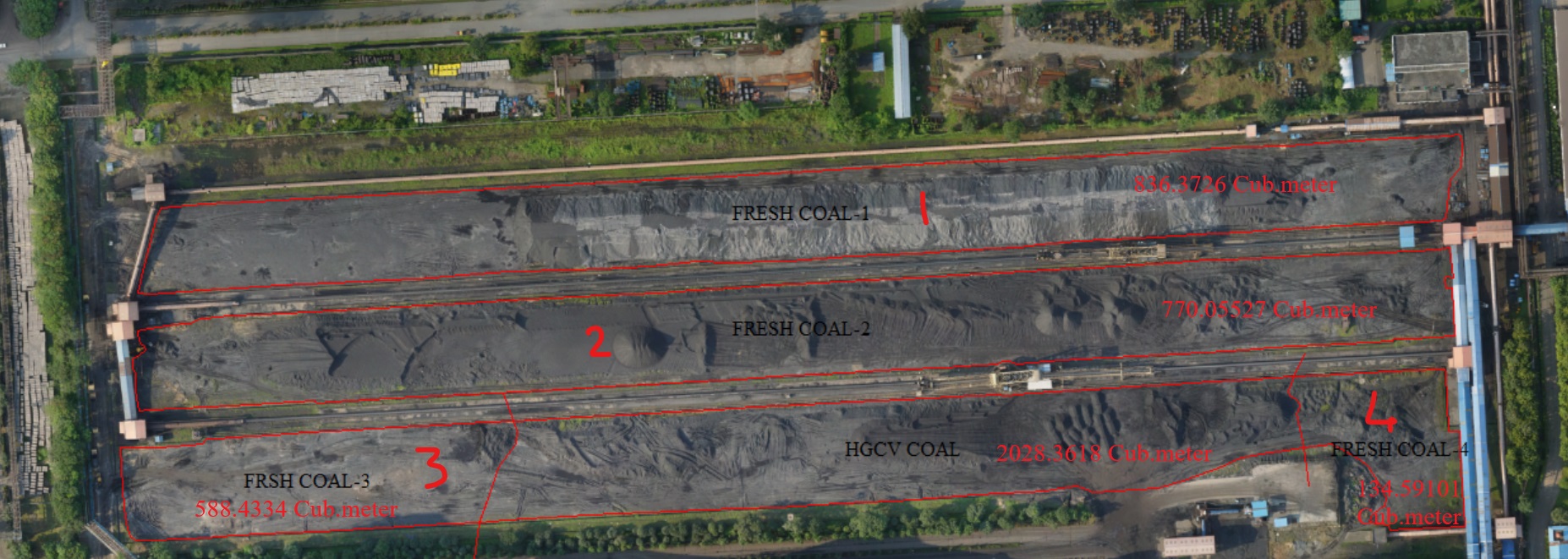
Precisely measure ROM coal, iron ore, or aggregate stockpiles using drone LiDAR. Automate JORC/NI 43-101 compliant reporting with millimeter-accuracy 3D models — eliminate manual surveying errors and expedite financial reconciliation.
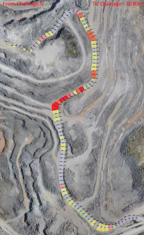
From haul roads and rail lines to power infrastructure, conveyors, and crushers – our drones capture high-resolution visual data that can be analyzed for wear, damage, or inefficiencies. Infrared capabilities help detect overheating or potential failure in electrical systems.
Patrol mine perimeters, fuel depots, and explosives storage 24/7 with autonomous drones. Detect trespassers, illegal mining, or equipment theft using AI-powered alerts — securing remote sites with zero personnel exposure.
Saurava Drone Services for the Mining Industry
Aerial Mapping & Surveying
RTK/PPK drones deliver high-precision 3D terrain maps—enabling faster, safer, and scalable site analysis versus traditional methods.
Stockpile Volume Reconciliation
Millimeter-accurate LiDAR models track ROM coal, iron ore, or aggregates for JORC/NI 43-101 compliant financial audits.
Terrain Mapping & Change Detection
Monitor pit progression, dump stability, and overburden with weekly drone surveys and ground deformation alerts.
Asset Management & Scheduling
Track mobile assets and detect wear using drone data—cutting downtime and optimizing maintenance planning.
Situational Awareness & Emergency Response
Thermal drones assist in rescue missions, methane leak detection, and flood/fire mapping—boosting safety response.
Infrastructure & Equipment Inspection
Inspect roads, rails, and plants without shutdowns using HD & thermal drones—detect faults, wear, and hotspots efficiently.
Security & Surveillance
Autonomous drone patrols monitor perimeters and detect unauthorized activity using AI, reducing need for on-site guards.
Blast Planning & Analysis
Use drone footage pre/post-blast for optimizing fragmentation, reducing flyrock risk, and ensuring safe explosive handling.
Environmental Monitoring
Monitor runoff, vegetation, erosion, and dust emissions for compliance reporting and environmental protection.
Why Drones Matter in Mining
Enhanced Safety
Avoids human exposure in hazardous zones, eliminating fall risks and heavy machinery interaction.
Cost Efficiency
Reduces labor, equipment, and time required for traditional surveys with drone automation.
Faster Decisions
Access real-time insights for quicker, more informed operational decisions in dynamic environments.
High Accuracy
Centimetre-level GPS data and HD imagery offer unmatched precision in terrain mapping.
Regular Monitoring
Schedule frequent drone flights to track progress, detect issues early, and optimize workflows.
Equipment We Use for Mining
Mining demands robust, reliable drone platforms with advanced sensor payloads. At Saurava Drones, we deploy equipment tailored to each job—ensuring the right tools are used for every scenario.
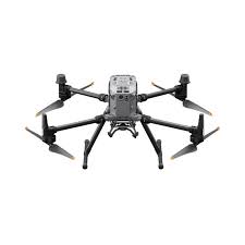
DJI M350
Ideal for high-end mapping, aerial visuals, and cinematic-grade cinematography in vast mining areas.
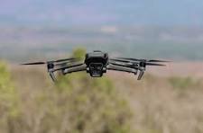
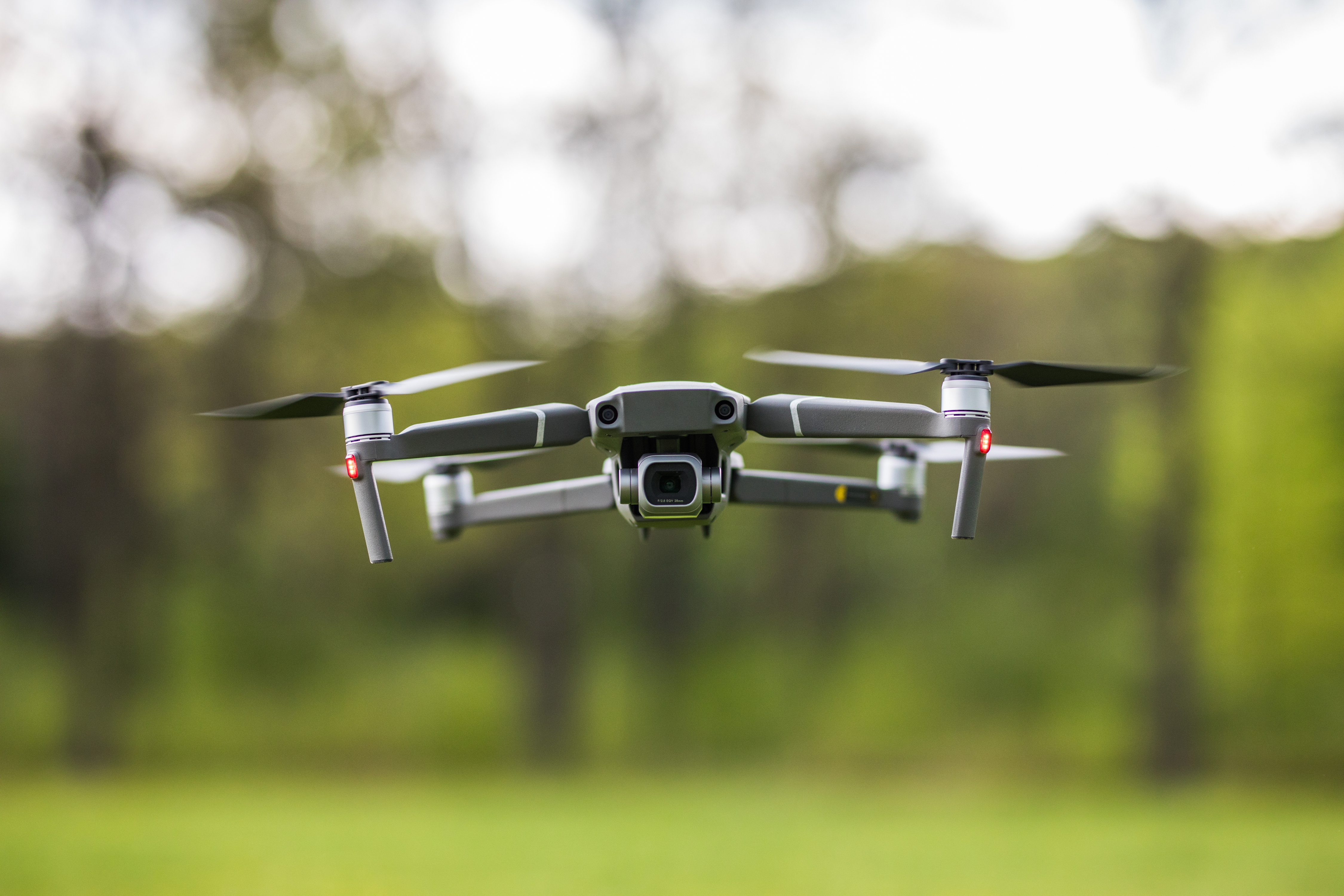
Mavic 3 Pro
Compact yet powerful—perfect for navigating tight zones and high-resolution reconnaissance missions.
Custom Thermal Drones
Used for immersive inspections, heat detection, and identifying anomalies without disrupting operations.
LiDAR-Equipped Drones
Deliver detailed terrain models and vegetation analysis—critical for planning and compliance reporting.
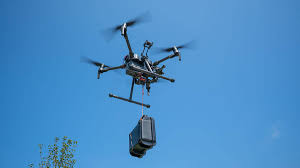
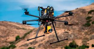
Payload Drones
Heavy-duty delivery drones capable of transporting up to 15kg of supplies or equipment within mining sites.